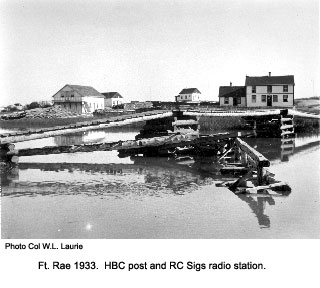
Position: 62:55N-116:00W. Opened in the summer of 1931 to provide weather information, contacts for boats and aircraft and communications for mining companies. It closed in August 1937 because the areas was unsatisfactory for radio operations and so the station was moved to Yellowknife.


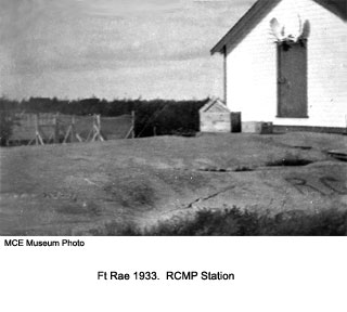
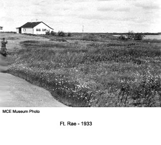
We have a desprepancy here in that the photo above, which also appears in the picture on the right below, was also identified in the original annotation to that picture as being the building in which Cpl Lang was burned to death. Both photos below are annotated "1933".
The picture on the left below (Museum picture) is of the same building as that in the photo on the right (Col Laurie's picture), but is in a somewhat delapitated condition and now has poles attached to each end. Does Col Laurie's notation "HBC house on right" refer to the building that is just visible on the right hand edge of the picture, or to this other house with the varanda?
If the house with the varanda is the RC Sigs station that burnt down, what is the little house with the high pole behind it ( identified abouve as the RCSigs station)? Could it have been the transmitter building? Was it perhaps the original RC Sigs station building in Rae?
If anyone can clarify these questions Please contact us.


